In this article we explore some of the key advances since the days of paper charts and sextants that are keeping modern ships safe from catastrophic accidents.
|
Getting your Trinity Audio player ready...
|
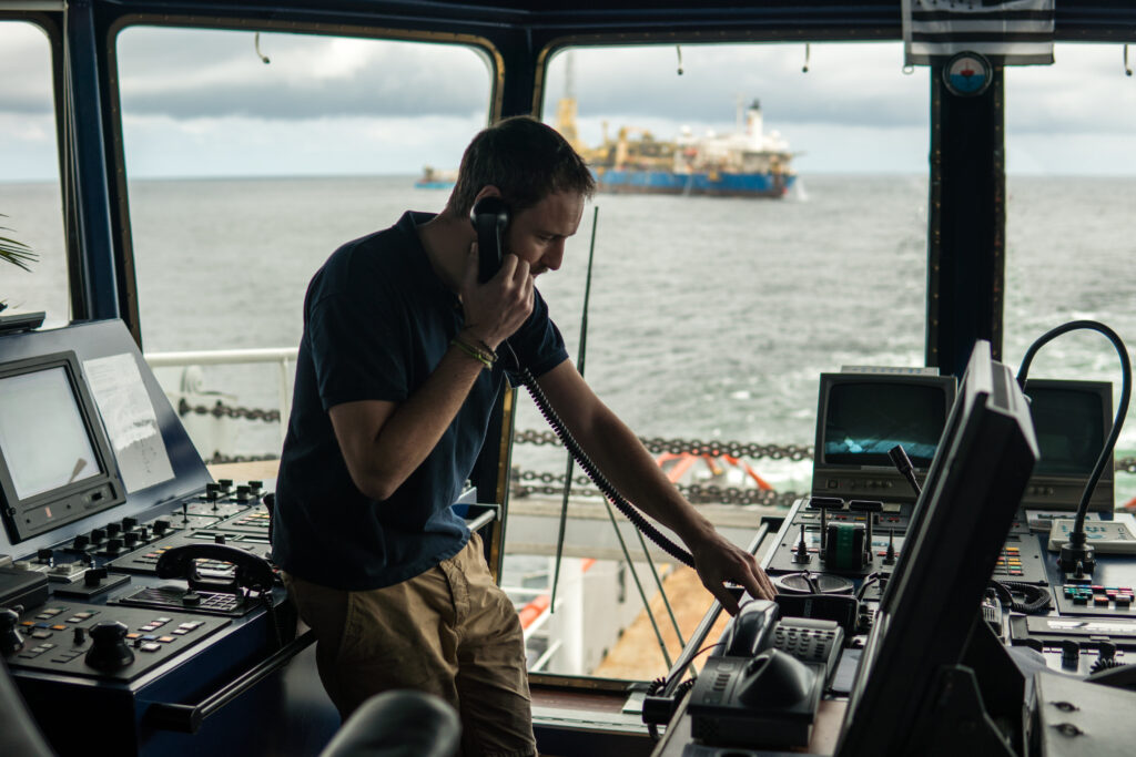
The officer of the watch on the bridge of a modern cargo ship or cruise liner is responsible for the safe navigation of these giants of the sea. They rely on an array of navigational technology to safely find their way and avoid collisions with other ships or natural obstacles. But how has navigational technology advanced in the past 50 years?
“Steady as She Goes” – Navigating a Ship 50 Years Ago
Even in the 1960s and 1970s, ships already had some impressive modern technology available. The increasing accuracy and reliability of gyrocompasses had made error-prone magnetic compasses obsolete except as a backup. Gyrocompasses rely on a rapidly spinning gyroscope to detect the rotation of the earth and point towards the centre of rotation at the North Pole.
The widespread use of radar onboard ships, originally developed for military application started to find application in civilian ships from the 1940s. This was a major advance allowing ships officers to effectively see in the dark or even in thick fog or low cloud. Later, Automatic Radar Plotting Assistance was added to help make sense of complex traffic situations by keeping track of objects the radar had picked up.
VHF radio was widely adopted and allowed ship-to-ship and ship-to-shore voice communication, replacing signal flags and semaphore. To fix the ship’s position, radio direction finding was used. Hyperbolic radio-fixing systems such as LORAN-A and DECCA were considered the state of the art in navigational technology. By triangulating the bearing of radio signal transmitters at known locations, the ship’s navigator was able to fix the ship’s position down to the accuracy of approximately one nautical mile, even in the open ocean. These radio-fixing aids simplified the navigator’s problem of determining how far from land the ship was but did not do much for precise coastal pilotage. Skilled local pilots with the ability to steer the ship from visual marks with knowledge of local currents and hazards remained critical to safe navigation.
Environmental Disasters Create a Focus on Safety
The 1970s and 1980s saw rapid developments in ships and shore-based technology. Global attention was focused on the environmental consequences of shipping accidents by a number of high-profile and severely damaging groundings and oils spills. Notable examples among these were the 1967 SS Torrey Canyon grounding and spill of more than 100 million litres of oil on the south coast of the UK, and the 1978 Amoco Cadiz spill of 256 million litres of oil on the beaches of Brittany. In Canada, the groundings and spills of the SS Arrow (1970, 10 million litres) and SS Kurdistan (1979, 6 million litres) drew attention to shipping risks in Chedabucto Bay and Cabot Strait.
In response, Traffic Separation Schemes (TSS) were established, commencing in 1967 with the Dover Straits (mandatory in 1971) and now extending to all areas of major marine traffic confluence. TSS, as the name suggests, create a system of separated one-way traffic lanes. The routes are established through the IMO Convention on the International Regulations for Preventing Collisions at Sea (COLREGs), and implemented through national regulation, help to streamline traffic flow, reduce crossing and heads-on meeting situations, thus significantly reducing the risk of collision. The value of TSS continues to be recognized with new TSS being added each year to the list sanctioned by the IMO. The IMO established the TSS in the Strait of Juan de Fuca in 1981 and Canada now has 5 mandatory and 7 recommended routing systems.1
In conjunction with TSS, Vessel Traffic Services (VTS) were established to provide oversight of vessel movements. This was pioneered in Liverpool and Rotterdam in 1949 and 1956 respectively and was implemented in the very busy Dover Straits by 1973. VTS were initially quite rudimentary, comprising manual radar surveillance and radio call-in points for ship self-reporting. In recent years VTS have been augmented by digital ship tracking and sophisticated computer algorithms for highlighting collision and grounding risks. Trained VTS operators aid safety of navigation by alerting ships to dangers and providing a critical interface with search and rescue, pollution and other marine response agencies.
Military guidance systems help the development of GPS
Onboard the ship also saw revolutionary changes in technology in the 1970s and 1980s, starting with the development of satellite navigation systems in the 1970s.
The US Navy’s TRANSIT navigation system of determining terrestrial positions by cross-fixing obtained from radio Doppler-shifts was made available for civilian use and then superseded in the 1980s by the more accurate Global Positioning System (GPS), which determines distance by precise time differences. In the year 2000, all users were given access to the highest accuracy service when the military disabled a system they had been using to degrade accuracy for civilian users called Selective Availability.
The increased accuracy led to the explosion of geographic information systems (GIS) and georeferenced applications in all aspects of civilian life. Modern navigation systems now have access to American, European, Russian and Chinese2 satellite constellations simultaneously which allows them to accurately fix positions to within less than one metre. The combined constellation of technologies has been recognized with the acronym GNSS – Global Navigation Satellite Systems.
These high degrees of navigational precision provided by GNSS was complemented by the digitization of paper charts through Electronic Nautical Charts (ENC). The combination creates the ability for mariners to precisely view their position in space on the chart through an Electronic Chart Display and Information Systems (ECDIS). The result is highly accurate, fully automatic electronic navigation available both commercially and recreationally.
Automatic Identification Systems (AIS) Uses Radio Data to Help Avoid Collisions
Ships still had to rely on radar, radio communication or visual observations to detect other ships until the advent of Automatic Identification Systems (AIS). AIS is a system of automated VHF radio transmissions that exchanges between ships key identification and navigational data such as a ship name, IMO number, type of ship, destination, activity/status (underway, anchored, fishing, etc.) position, course, and speed. The information is displayed on the ship’s navigation system (radar or ECDIS) as symbology with leaders to indicate true and relative movement. In this way, the navigator is able to correlate ships with radar contacts, and to immediately identify them for bridge-to-bridge radio communications in resolving collision avoidance situations. This same technology has also aided marine safety with the use of Virtual Aids to Navigation (V-AtoN) to highlight navigational hazards or temporary exclusion zones. These are navigational warnings or dangers transmitted to the ship’s radar/chart plotters as symbology, showing apparent contacts through AIS technology without the need for a physical object like a warning buoy.
Autopilots and Satellite Connectivity
The cross-referencing of radar and geographic (charted) information on both radars and ECDIS, combined with AIS, gives navigators the ability to make risk assessments and decisions based on accurate and complete information, even in low visibility conditions. It is even possible for ships to follow planned tracks through the use of autopilots. Such autopilots can operate in three modes: course maintaining, track-following, and route-following. Most ships use the first, with the bridge watchkeeper making adjustments for track following, maintaining personal awareness of the ship’s set and drift. Almost always in situations of critical pilotage or complex traffic, and in heavy seas, ships will revert to hand steering for greater control and quicker response.
Communication technology also advanced significantly in the last few decades of the 20th century. Increasing prevalence of mobile phone data connections has created the opportunity for real-time acquisition of weather, wind, bathymetry, water-level and air-gap data through localized networks. Satellite communication initially opened the door to voice communication even when outside of the range of VHF radio. Increasingly, satellite communication is used for data. Lower-cost satellite internet brought about by low-earth orbit satellite technology (e.g., Starlink, Telesat or Iridium) means that modern ships can now have access to real-time data sources over extended ranges, subject to satellite coverage and service subscription.
Ever Higher Standards for Baseline Technology
The baseline of navigational equipment in ocean-going ships varies by tonnage. The table below summarizes required navigational equipment in accordance with Canada’s Navigational Safety Regulations (NSR) 2020, which mirror the IMO’s SOLAS Chapter V requirements.
| Mandatory Equipment by Tonnage | <150 GT | 150 GT+ | 300 GT+ | 500 GT+ | 3000 GT+ | 10,000 GT+ | 50,000 GT+ |
|---|---|---|---|---|---|---|---|
| Steering Magnetic Compass | x | x | x | x | x | x | x |
| Gyro Compass | x | x | x | x | x | x | |
| GNSS Receiver | x | x | x | x | x | x | |
| Pelorus | x | x | x | x | x | x | |
| Spare Magnetic Compass | x | x | x | x | x | x | |
| Daylight Signalling Lamp | x | x | x | x | x | x | |
| Echo Sounder | x | x | x | x | x | ||
| 9 GHz radar | x | x | x | x | x | ||
| Speed Log | x | x | x | x | x | ||
| Automatic Radar Plotting Assistance | x | x | x | x | x | ||
| Helm and Engine Repeaters | x | x | x | x | |||
| Second radar (3 GHz or 9 GHz) | x | x | x | ||||
| Autopilot | x | x | |||||
| Rate of Turn Indicator | x | ||||||
| Voyage Data Recorder | Passenger | x | x | x | |||
| ECDIS | Passenger | x | x | x | |||
| AIS | Note 1 | x | x | x | x | x | x |
| Two-way voice (radio) | x | x | x | x | x | ||
| Corrected charts and pubs | Note 2 | x | x | x | x | x | x |
| Notes | 1 | Vessels >20 m other than pleasure craft, and vessels with >50 passengers, towboats >8 m, and vessels with hazardous cargoes | |||||
| 2 | All vessels, but <100 GT may be exempt if the master has local knowledge; maybe ENC | ||||||
While the standard set of technologies varies depending on size of the ship measured in gross tonnes, the common technologies for even small ships (GPS, ECDIS, Automatic Radar Plotting Assistance, radars, AIS, autopilot, satellite communications and internet connectivity) is a very significant step up from the mid-60s, at which time even large, modern ships were being navigated on paper charts with rudimentary radio navigation aids, with hand-plotted collision avoidance on simple radars.
Pilots Bring Advanced Technologies to Complement Their Skills
The trend in digitalization and connected technology seen in ships has also been mirrored in the technology deployed by the pilots who board the ships to safely navigate them through the challenging waters close to port. Portable Pilotage Units (PPU) are personal tablet computers carried by the pilot, and they replace the detailed course books that the pilots in the 1960s and 70s carried with them. PPUs give the marine pilot a reliable, accurate and independent source of navigation information. Previous to the introduction of PPU’s, pilots were reliant on the ship’s fitted equipment (gyros, radars, echo sounders, paper charts, etc.), augmented by visual navigation enabled by memorization of courses, leading marks, clearing bearing and other traditional pilotage methods. The key benefit of PPU’s is the availability to the pilot of highly accurate positional and navigation information that enables precise navigation independent of any possible faults or failures in the ship’s fitted systems. With cellular telephone data connection or ship Wi-Fi, there is now also a possibility of integrated live feeds of current local hydrographic information such as water levels.
Safely Navigating Ships Into the Future
The safety record of international shipping has advanced dramatically since the early 1900s when the global fleet would lose 1 ship in every 100 to sinking according to data collected by Lloyd’s Register. Nowadays these types of accidents are extremely rare, with only 38 ships lost in 2022 in a global fleet of more than 130,0003 .
Since the era of paper charts and sextants, navigation technologies have undergone a remarkable transformation. Satellite navigation systems, sophisticated radar, electronic charts and real-time communications are just some of the innovations that have revolutionized the way ships navigate at sea.
These technological advances have not only improved navigational safety, but also optimized the efficiency of maritime operations. Ships can now navigate on more precise routes, reducing fuel consumption and emissions. Vessel traffic management systems and vessel tracking technologies enable better coordination and visibility of movements, reducing the risk of collision.
As we look to the future, the horizon for navigation technology looks even brighter. Artificial intelligence, machine learning and augmented reality have the potential to further transform marine navigation, making it even safer, more efficient and more sustainable.
This article originates from Clear Seas Research into the Technology Implications for Marine Pilotage. Find out more about this project here.
About the Author
RAdm Nigel Greenwood, RCN (Retired), FRIN, FNI, holds a BSc in Physics and Oceanography, as well as an MA in International Studies. He is a naval veteran and qualified master mariner, who maintains seagoing currency in seasonal employment as an ice navigator in the Canadian Arctic, and as a local small-craft sailor. His consultancy, Greenwood Maritime Solutions Ltd (GMSL), specializes in Threat and Risk Assessments, Operations Research and Maritime Operational Studies. GMSL has previously conducted operational studies and assessments for the Pacific Pilotage Authority, the Canadian Hydrographic Service, Transport Canada, Defence Research and Development Canada, the BC Ministry of Transportation and Infrastructure (Highways Branch), and the Canada Port Authorities of Prince Rupert and Vancouver.
- Canadian Coast Guard, Annual Notices to Mariners 2024 ↩︎
- These systems of the European Union, Soviet Union/Russia, and People’s Republic of China are known respectively as Galileo, GLONASS, and BeiDou. ↩︎
- Allianz Global, Safety and Shipping Review 2023 ↩︎


