New mapping tool and associated report developed to support marine spatial planning in Canada’s Pacific Coast.
Vancouver, BC, October 6, 2020 – Clear Seas Centre for Responsible Marine Shipping (Clear Seas) has launched an interactive tool to assess the sensitivity of coastal areas to oil spills. The Sensitive Coastal Area (SCA) tool will help the shipping industry, regulators and coastal communities plan marine activities by better understanding the sensitivity of the coast in the event of an oil spill caused by marine shipping activity.
The SCA tool, commissioned by Clear Seas and developed by Dillon Consulting Limited, has been initially applied to Canada’s Pacific Coast. The study assessed sensitivity to oil spills of the coastline and sea floor, any animal and plant species present, and any socio-economic activities. This tool is the first time that these sensitivities have been combined in an interactive, publicly accessible format.
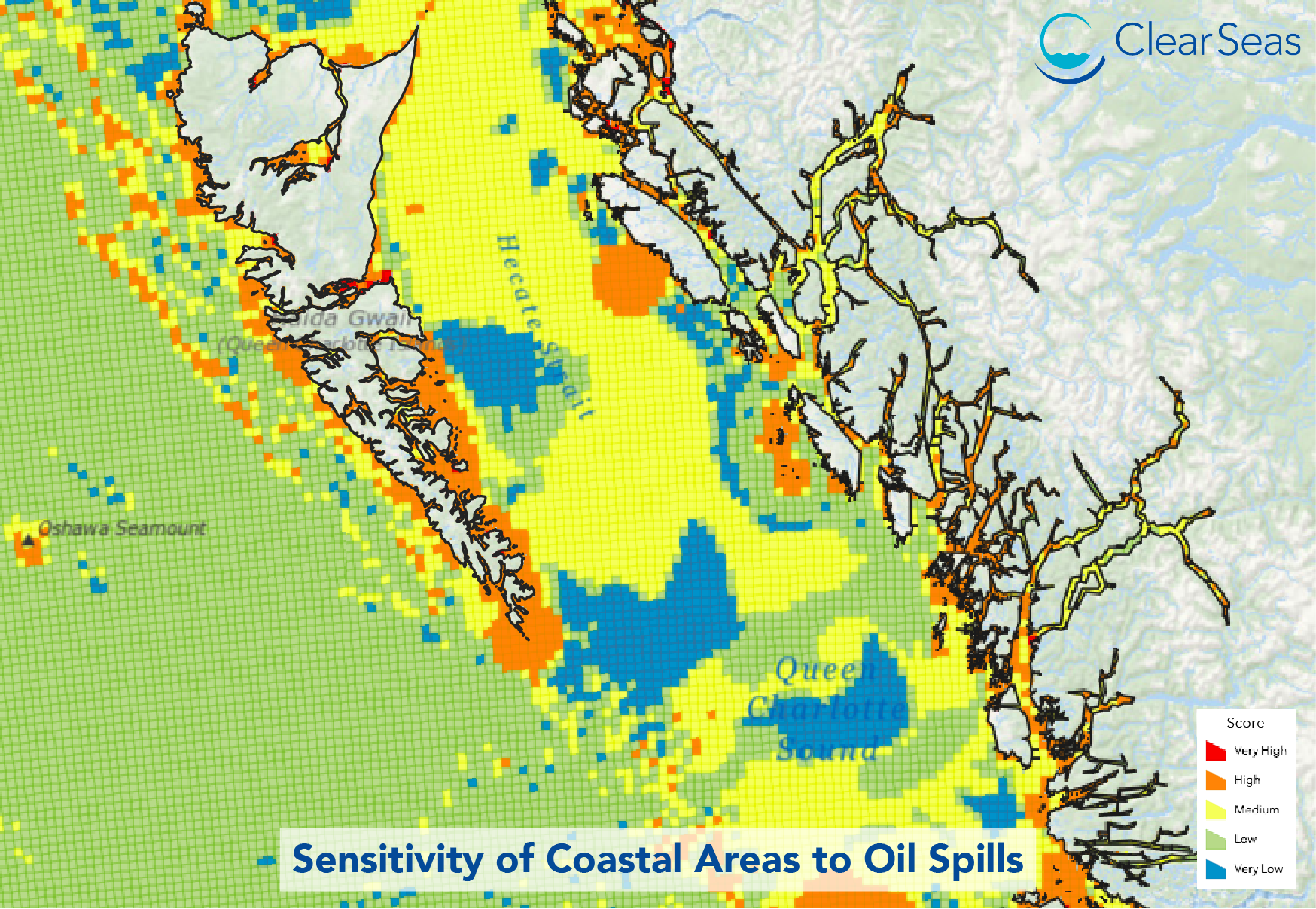
As new projects like liquefied natural gas exports and marine terminal expansions are evaluated, and the location of shipping lanes is assessed, the SCA tool will provide planners and developers with new insights to support the planning, approval, development and operation of these and other uses of the coast. The specialized mapping tool is part of Clear Seas’ Marine Transportation Corridors initiative – which allows planners to consider sensitivity when managing shipping needs in the context of other coastal uses. Planners can then avoid areas of high sensitivity or focus risk mitigation activities on those areas most in need of protection.
The SCA tool combines three categories of publicly available data using a highly detailed interactive web-map incorporating geographic information system (GIS) databases. The data is divided into a grid of two nautical mile cells that, in this first application, assessed 443,000 km2 of BC’s coastal waters.
The decision to use publicly available datasets with no licence restrictions is driven by Clear Seas’ commitment to disseminate information widely for public benefit as part of its mandate to provide fact-based information to facilitate informed dialogue.
All of the assumptions and methodologies associated with creating the SCA tool are provided in the full Clear Seas report available for download here.
ABOUT CLEAR SEAS
Clear Seas is a not-for-profit independent research centre that provides impartial information on marine shipping in Canada to policy makers and the public. Its mandate is to initiate and interpret research, analyze policies, identify best practices, share information and facilitate dialogue. Clear Seas is funded by Transport Canada, Alberta Energy and the Port of Vancouver. In order to remain independent and impartial, Clear Seas operates at arm’s length from its funders. The organization’s research agenda is defined internally in response to current issues, reviewed by a research advisory committee, and approved by a board of directors. Clear Seas collaborates with Indigenous groups, stakeholders and experts to identify knowledge gaps, share results of existing studies, and facilitate new research to ensure decision makers have access to accurate, up-to-date information. All reports and findings are available at clearseas.org
MEDIA CONTACT:
Edward Downing
Director of Communications
Tel.: (604) 408-1648 ext. 106 or cell (604) 817-3058
edward.downing@clearseas.org